
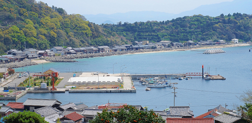
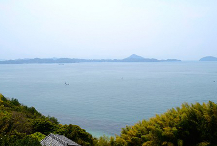
Muzukijima Island is located in the centre of west part of Seto Inland Sea.
The old houses with fancy traditional gates called “Nagayamon” stand on the east coast.
“Muzuki Skyline” is the path around 2 mountains and one of the best hiking routes with a wonderful view. There are walking routes mimicking the pilgrimage of 9km-long “Shima Shkoku 88 Ka Shyo (Island Shikoku 88 Pilgrimage” on the westside and 7km-long “Saigoku 33 Syo (Kansai Kannon Pilgrimage) ” on the eastside. There are also attractive sightseeing spots, such as “Umenokojima (Umenoko castle ruins)” and “Meotogusu ( Husband and wife camphor trees)” .
Mandarins and lemons are extensively cultivated on the slopes of the mountains.
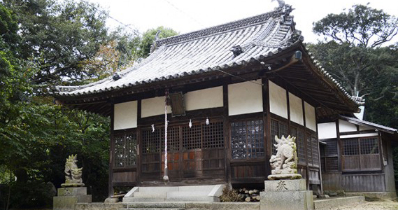
Toudaihachiman Shrine, a historical shrine located further in the village close to Muzuki port, was founded approximately 1100 years ago. It is said to be the transfer a deity of Engi era 4 (year 904) or Kaho era (year 1094).
The three goddesses, Tagorihimenomikoto, Ichikishimahimenomikoto, and Tagitsuhimenomikoto are worshiped. In the shrine precinct, beside the Torii gate, a stone monument of an autograph of Nogimaresuke, a rare shaped guardian dog, and hydrangeas in full bloom can be seen during rainy seasons.
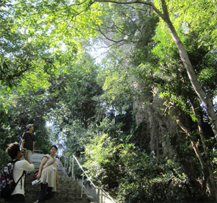
Meotogusu are large camphor trees beside the stairs of Gyokuzen Temple, which is one of the Fudasho (temples where amulets are collected) that connects Shikoku Island. The camphor tree, with a seven meter circumference, has white flowers blooming between May and June, and is more than 300 years old. The trunk is split in two, giving the name Meotogusu, which means the husband and wife camphor tree. Meotogusu is designated as Matsuyama city’s natural monument.
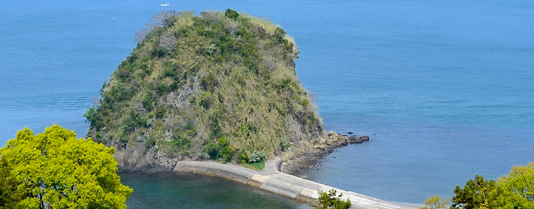
During low tide, people can walk across to “Umenokojima Island” located in Imoko strait that can be seen from the east route of Muzuki Skyline. On Umekojima Island, with a 32 meter altitude and about a 200 meter circumference, there is a ruin called “Ruins of Umekojima Island Fort”. The fort of Umekojima Island is located in an important place, the sea entrance to Nakajima Island, and was an impregnable fortress because the view was clear to Motoyama Castle and Taizan Castle.
The farm road that circles two mountains on the east and west of Muzuki Island is called Skyline due to the beautiful mountain roads, and the view of the ocean and small islands through mikan fields. The paved gradual slope is best suited for hiking. On the west, there is an approximately nine kilometer route of 88 temples of Shikoku Island. On the east, there is another route through 33 temples of Saigoku that is approximately seven kilometers. Umenokojima Island can be seen from the east route of Muzuki Skyline.
■Ferry
Mitsuhama Port - Muzuki Port (45 min)
Takahama Port - Muzuki Port (30 min)
■High-Speed Boat
Takahama Port -Muzuki Port (18 min)
Ferry Information : Nakajia Kisen Co. Ltd.
There is no accommodation facility.
Grocery stores are located around Muzuki Port. One vending machine is placed in front of Kusu Shopping Area.
